By default, Tableau uses default Maps to display the spatial data. However, you have the option to use your own Background Maps. In this article, we will show you how to use Mapbox Maps as a Background Map in Tableau with an example.
For this Mapbox background Maps demo, we created two sample styles in our account. If you want, you can use the default Mapbox styles
For this Tableau example, we are going to use Sample – Superstore data sources that come with the desktop.
How to Use Mapbox Maps as a Background Map in Tableau
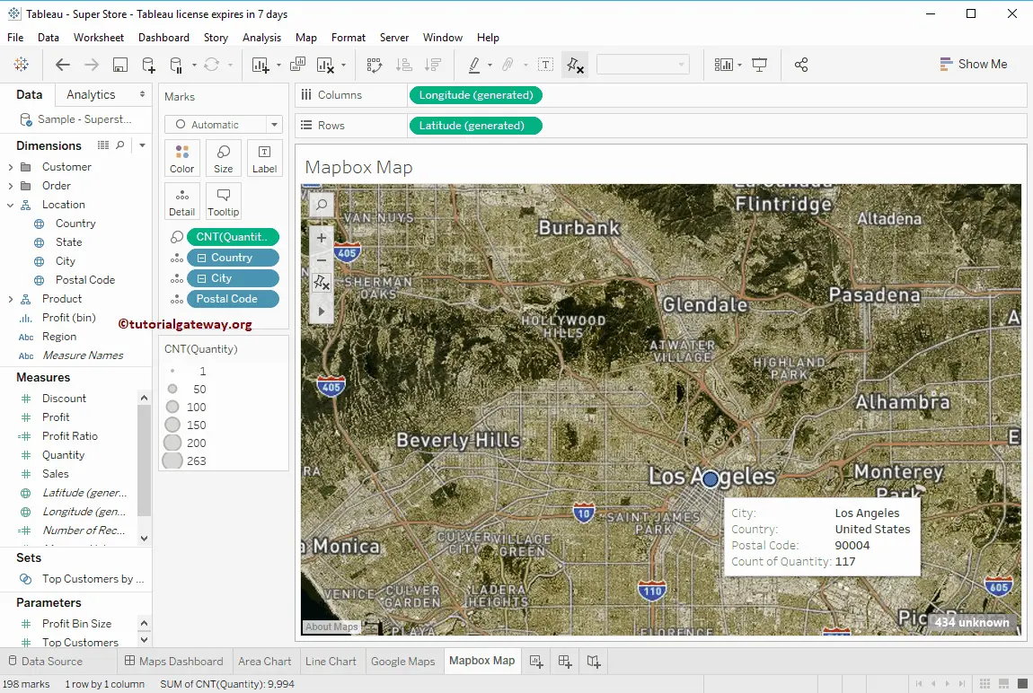
Before we start using Mapbox Maps as a Background Map, let me first create a Symbol. To do so, drag and drop the Postal Code dimension to the Details card present in the Marks Shelf.
Now, you can see the auto-generated symbol map.
Let me add City to Details card and Count (Quantity) to Size. It means the Circle size will depend upon the Number of Orders.
To use Mapbox Maps as a Background in Tableau, go to the Map, select Background Maps, and then select Map Services… from the drop-down Menu
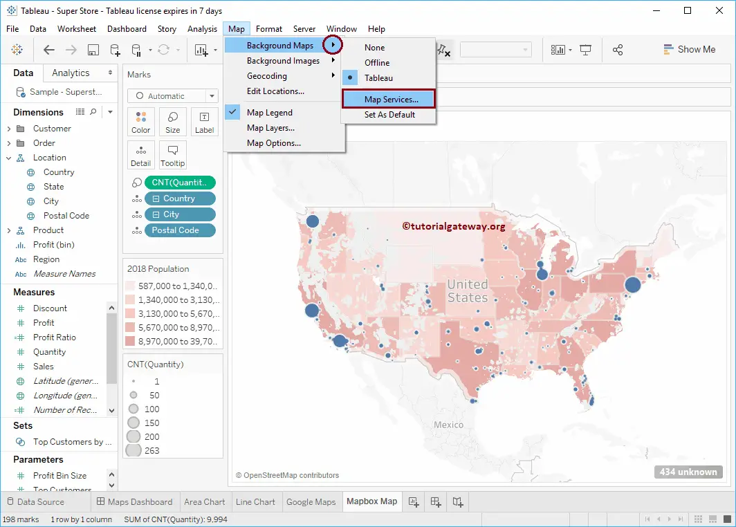
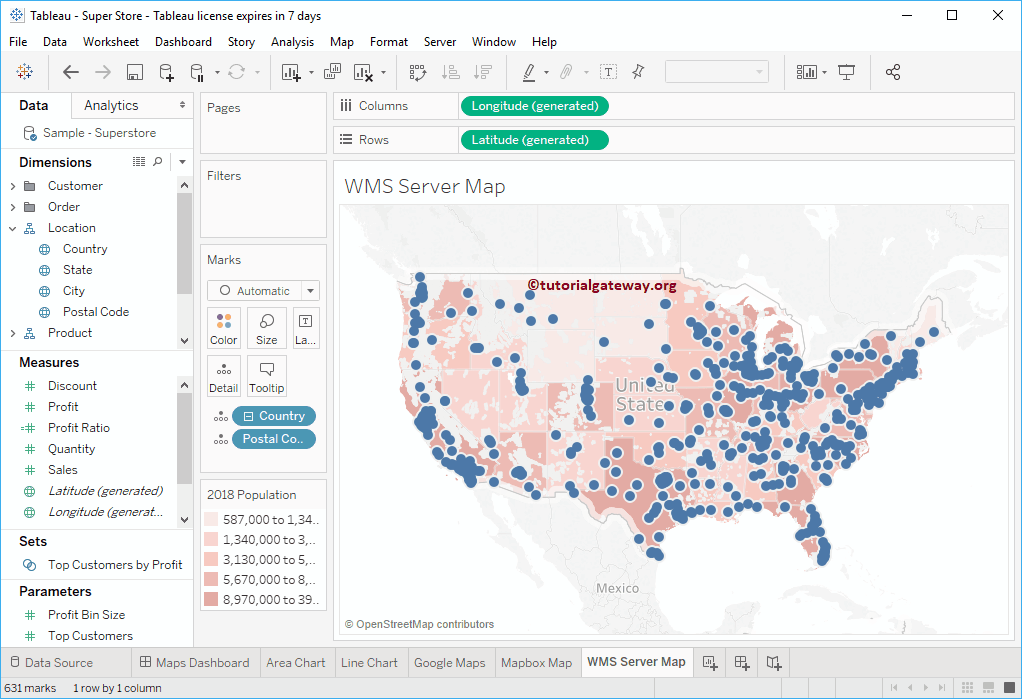
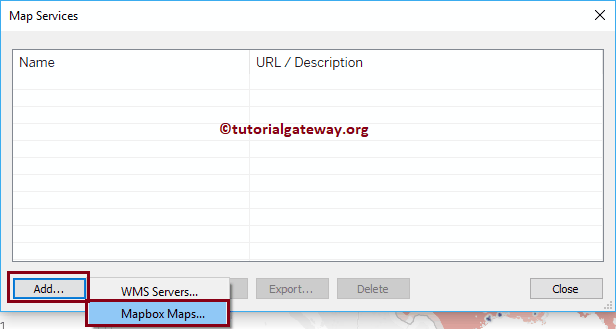
Selecting Map Services… will open the Map Services window. Please click the Add… button and choose the Mapbox Maps.. option. Please refer to the WMS Server as a Background to understand the WMS Servers.. option.
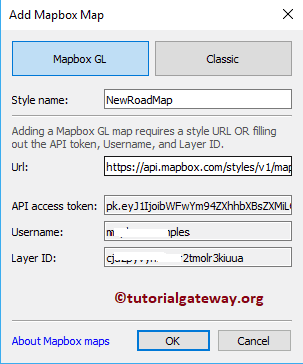
Selecting the above Tableau option will open the Add Mapbox Map window to change the Background.
- Style Name: Please specify a valid style name.
- URL: Specify the URL where your Mapbox map is present.
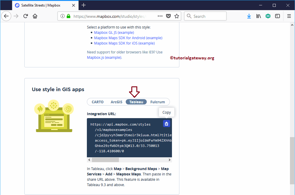
Please go to the Mapbox website and go to the Style section. Next, select the style that you want to use, and select Share, develop & use from the Menu
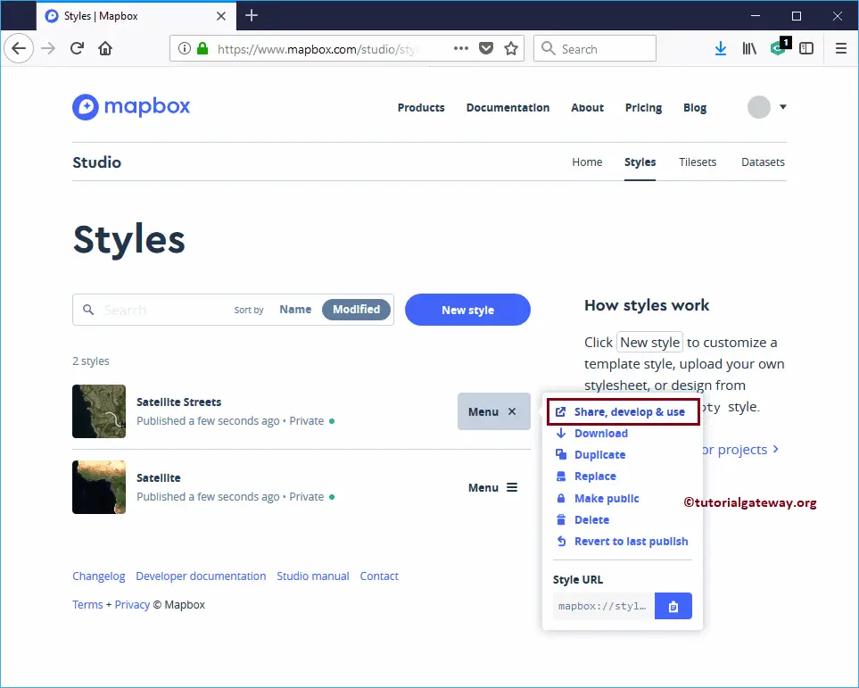
It will navigate you to a new page. Please copy the Code under the Use Style in the GIS Apps section. Remember, don’t forget to select the marked option to use Mapbox maps.
Pasting the URL will automatically add the API Access Token, Username, and Layer ID. Click OK to close the Add. Mapbox Map window. Next, click the Close button to close the Map Services window.
Now you can see that our Tableau default was replaced by the Satellite map that we created in Mapbox. If you want to check which Background Map is used currently, go to Maps -> Background Maps. You can see it is using NewRoadMap instead of Tableau.
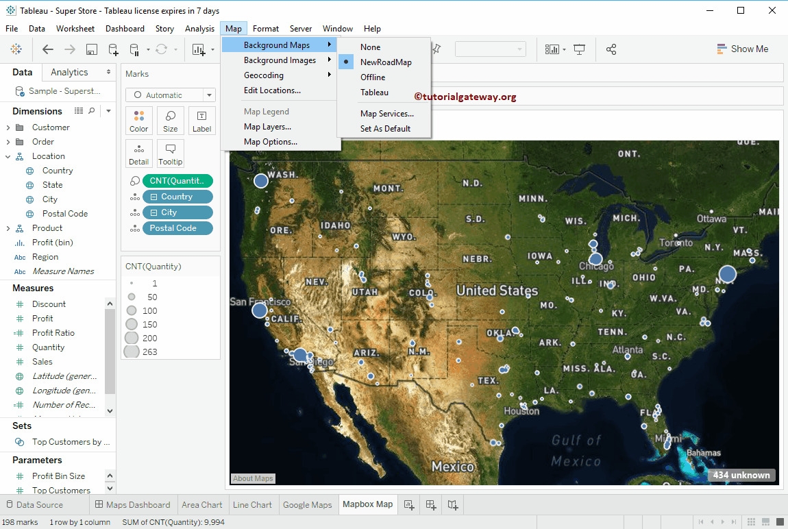
You can Zoom any particular location of the Mapbox Maps as a Background Map.