In this article, we will show you how to use Google Maps in Tableau with an example. For this Google Maps demo, we are going to use Sample – Superstore data sources that come with the desktop.
How to Use Google Maps in Tableau
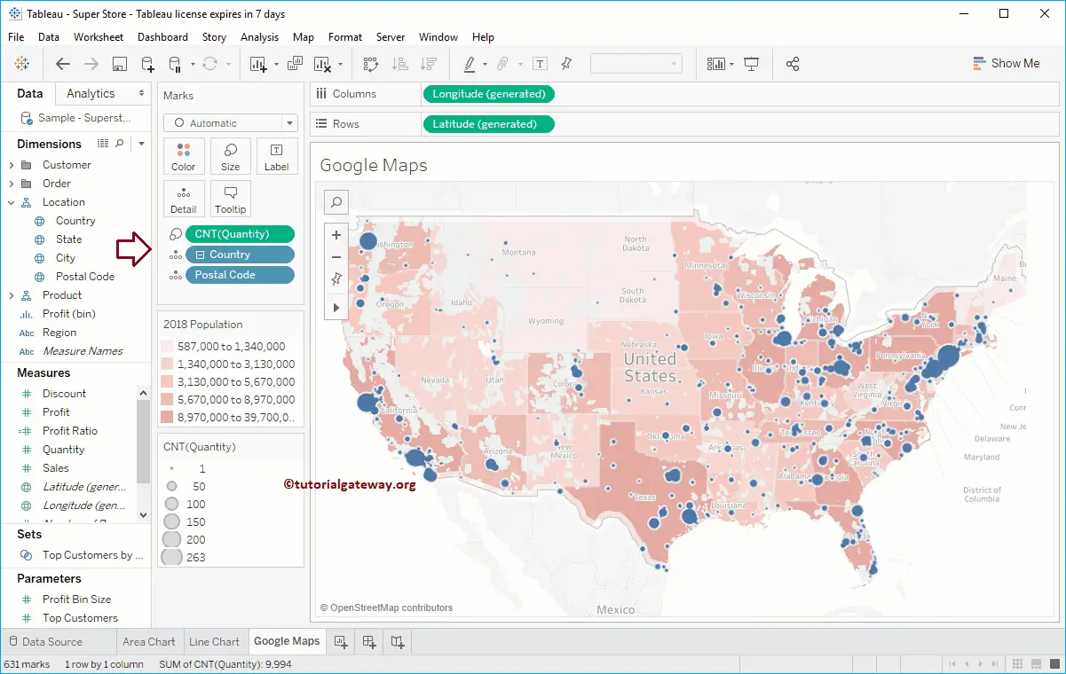
Before we start using Google Maps, let me first create a Symbol Map. To do so, drag and drop the Postal Code dimension to the Details card present on the Tableau Marks Shelf.
Now, you can see the auto-generated symbol map. Let me add the Count (Quantity) to the Size. It means the Circle size will depend upon the Number of Orders
How to use Google Maps in Tableau Worksheet
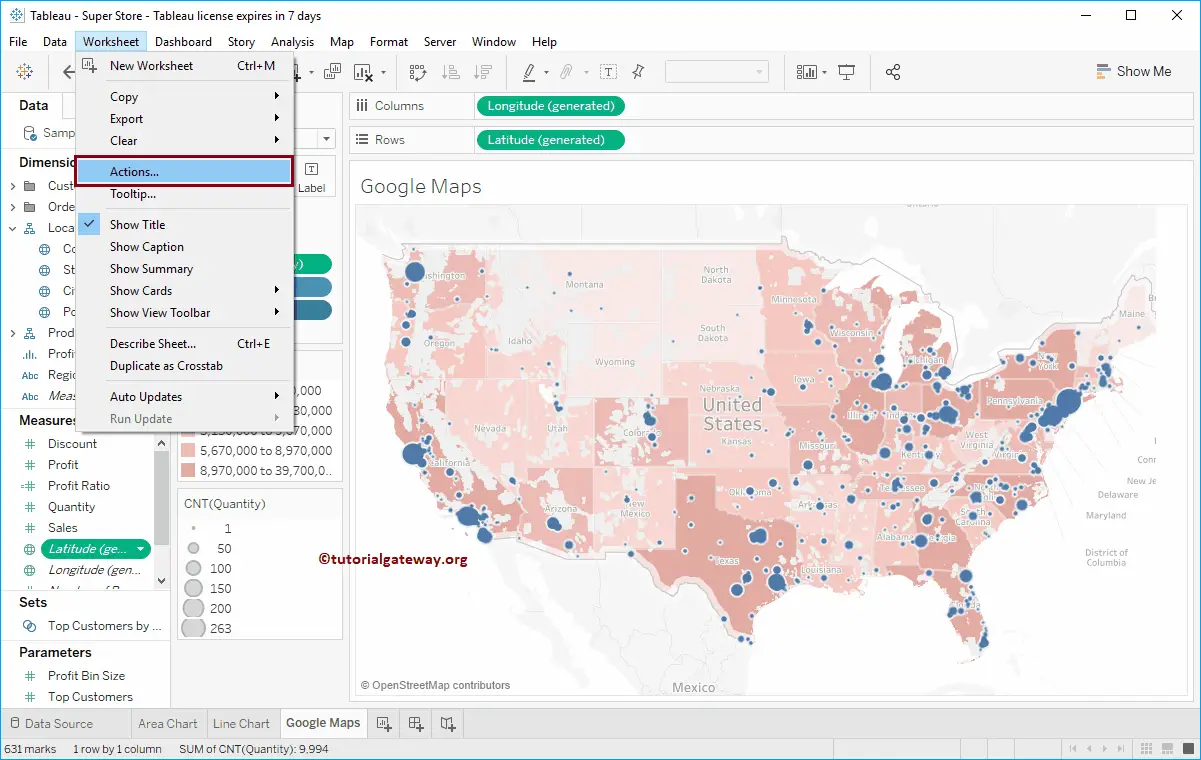
To use Google Maps, go to the Worksheet and select Actions.. from the drop-down Menu
Once you select Actions.., the below-shown window will be opened. Click the Add Action button and select the URL.. option
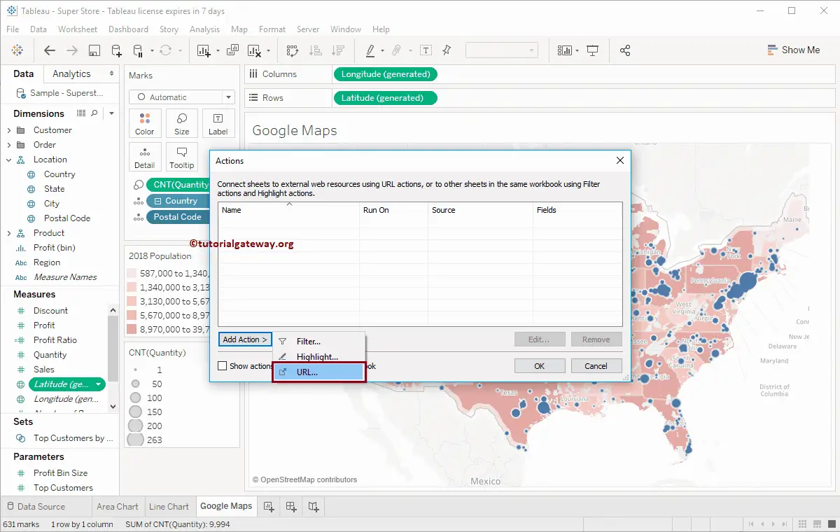
Selecting a URL will open the Add URL Action window
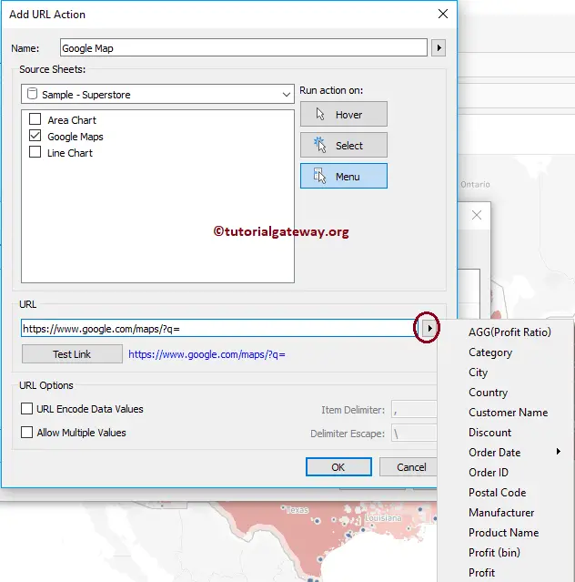
- Name: Provide a Valid name
- Source Sheets: Please choose the selection from which you want to perform this action. I mean Map
- Hover: If you select this option, the Map will open when you hover over it.
- Select: The map will open when you select a specified point.
- Menu: Use Menu to open Map
- URL: Please specify the URL
We named it Google Map and used this for Google Maps sheet, and it will run when you select a point. The URL you have to use is: https://www.google.com/maps/?q=
Please click the side arrow to select the Latitude and Longitude. As you can see, we don’t have any existing latitudes and Longitudes in both Dimensions and Measures. If your Data source has those things, they select them.
How to use Google Maps in Tableau Dashboard
Before we start using Google Maps in the Dashboard, let me create a Dashboard first. Next, we added the Google Map that we created previously to this Dashboard.
Next, drag and drop the Web Page from the Objects region to the Dashboard bottom region. Dropping a Web Page will open the Edit URL window. Please leave it blank or specify the default URL name and click OK.
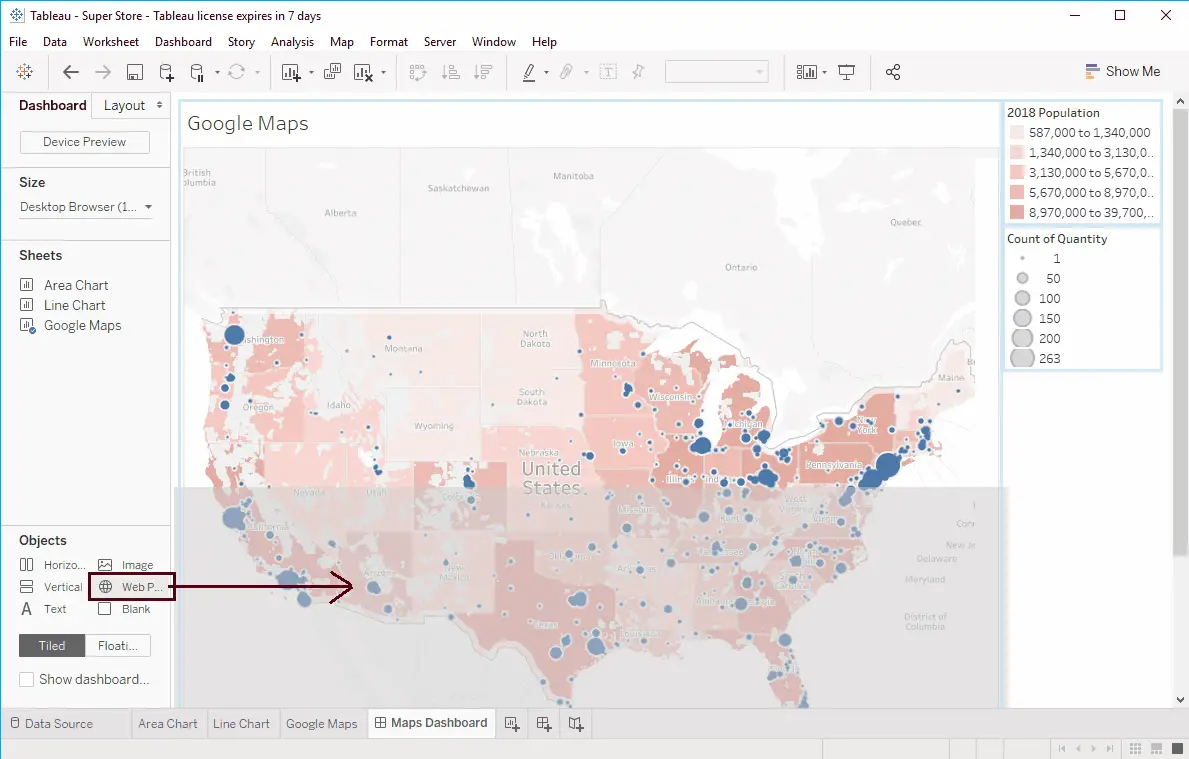
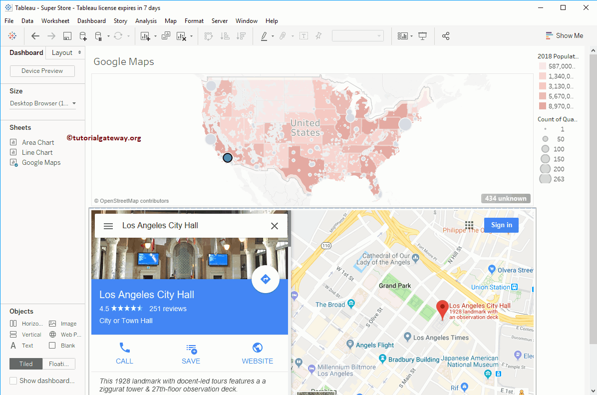
Now you can see our Dashboard has One Symbol Map and a Web page. To use Google Maps in the Tableau dashboard, go to the Dashboard and Select Actions.. from the drop-down menu
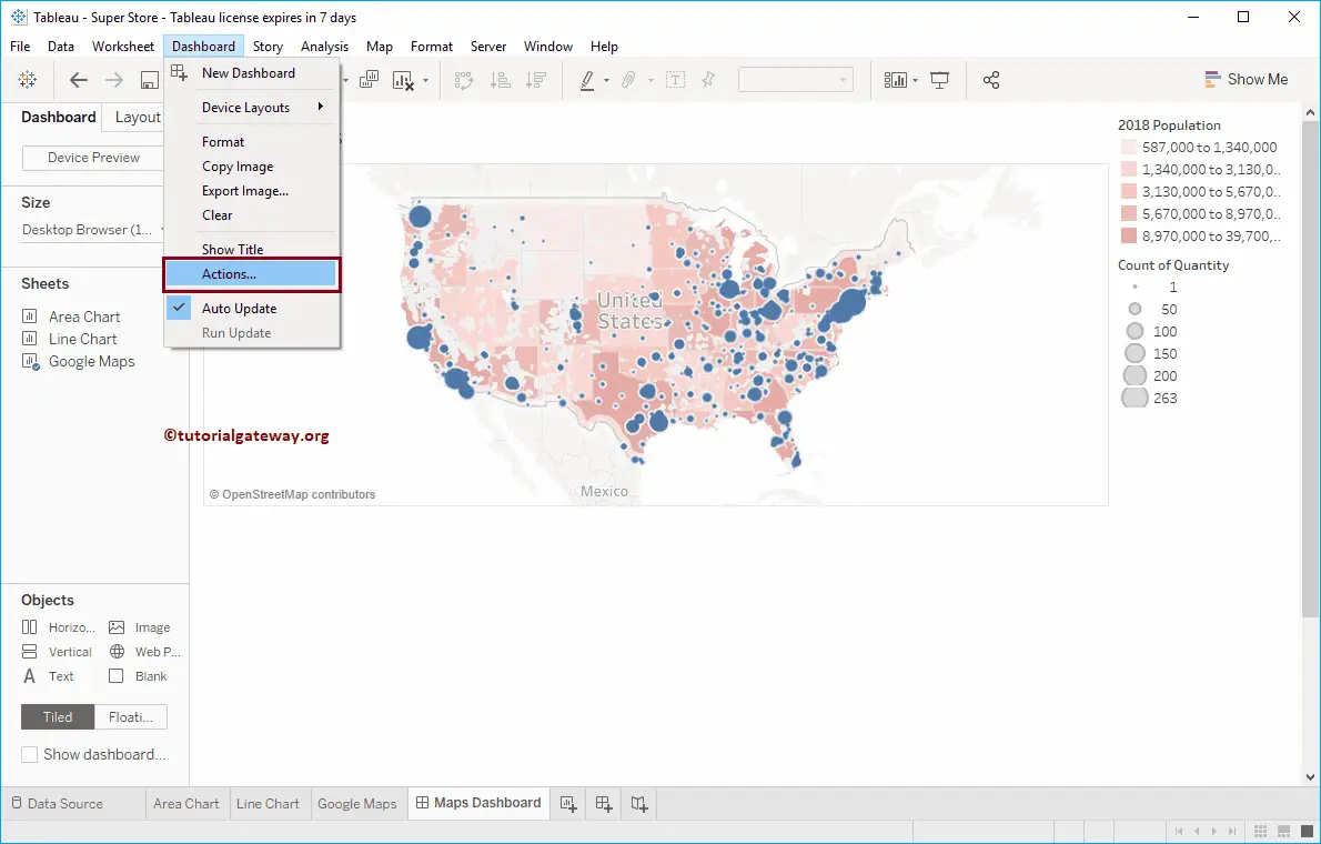
Once you select Actions, the above-mentioned Actions window will open. Here, please click the Add Action button and choose the URL option.
Selecting the URL will open the Add URL Action window. We already explained these properties in our previous example. Here, we named it Google DB Map, and it will run when you select a point. The URL you have to use is: https://www.google.com/maps/?q=
Please click the side arrow to select the Latitude and Longitude. As you can see, we are choosing the Latitude that was auto-generated by Tableau when you add the Postal Code to maps.
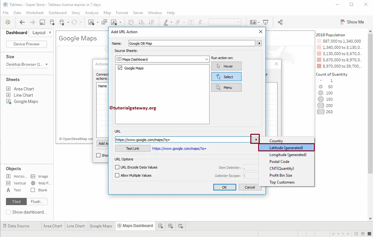
Similarly, add longitude to the URL. Now the URL will be https://www.google.com/maps/?q=<Latitude(generated)>,<Longitude(generated)>
Click OK to close the Add URL action window. Next, click the OK button to close the Actions window.
Let me select Los Angeles from the Map, and you can see the Google Map of the Specified Postal Code. If your Data has the proper address, then Tableau Google Maps will display that building as well.
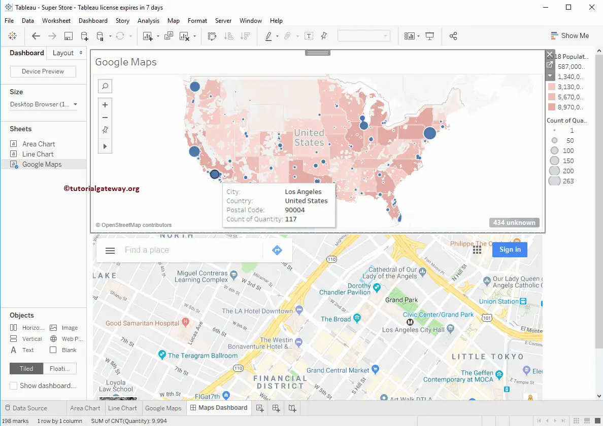
By selecting the location, you can explore the Google Maps options like Directions, calls, etc.
Let me show you the view of the below-shown image.
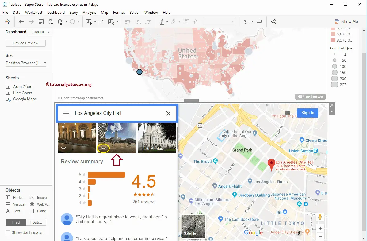
And you can see the City hall
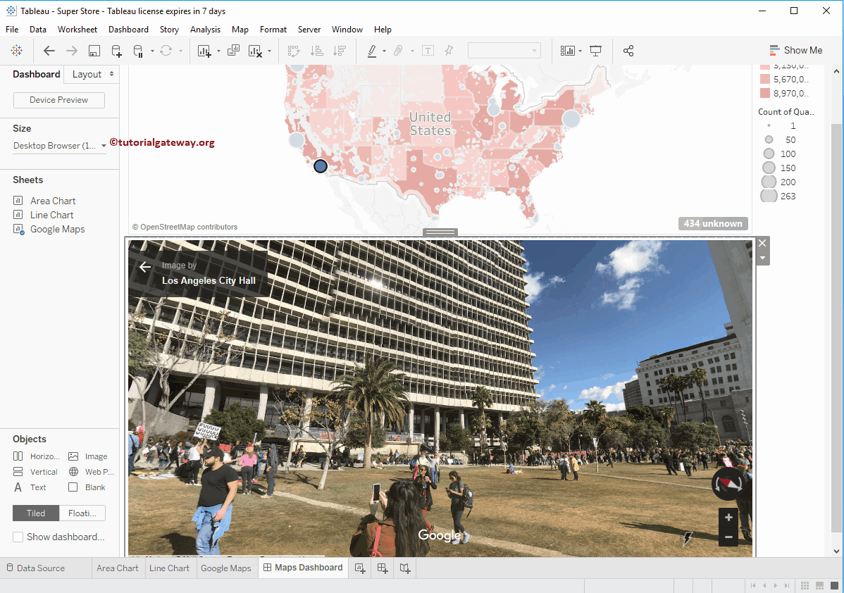
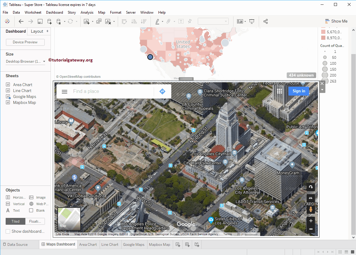
You can also select the Satellite View from this Tableau Google Map
Comments are closed.